Tripod Mounted or Mobile 3D Laser Scanning: Which is the right one for the job?

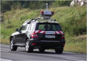
Riegl Scanner Mounted On Automobile

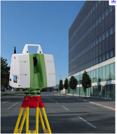
Leica C10 Terrestrial Scanner
Having worked many years with terrestrial lidar platforms, I have had the unique experience of watching the industry grow and expand. I have attended Leica conferences and Spar conferences in Texas and California every year since 2005 and I have been very impressed with seeing the innovations in 3D Laser data collection platforms. In this article I have purposely decided not to discuss the airborne platforms of fixed wing and helicopter, I will save that for another time. I have spent a lot of time with the tripod based Leica Scanning systems of the last 6 years. At the same time, at the Spar conference and other equipment shows I also studied the Trimble, Faro and Riegl products as well as others that are excellent systems. The point of this article is to compare the conditions and cost analysis of using a fixed tripod base 3D Laser Scanning system compared to a mobile truck or automobile mounted system for scanning road way corridors in database preparation for Federal, State, and County transportation projects.
General Project Specifications
While specs change from state to state these are the key factors: Typically the engineer will request a corridor that is 200’ wide, centered on the existing roadway. Sometimes it is wider and sometimes narrower. The spec for vertical accuracy is normally about .10 foot or less accuracy on “hard” pavement and concrete surfaces including the paved shoulder. All other surfaces in the corridor have to be within 6” vertical accuracy including bare ground, grass, overgrowth and thick vegetation. Horizontal accuracy is standard second order. Within the corridor you are expected to pick up all man made features- water valves, power poles, fire hydrants, pavement striping etc. In addition to this, the specifications you are required to have are a second order control point every 3000’ (sometimes closer), and a project control point every 1000’. So this is the scope we are working toward for comparison of the two 3D Systems.
Comparison and Capabilities
The first thing to remember is that Laser Scanning is very precise on hard surfaces like pavement, houses, and power poles and not very good in vegetation. I know that many software packages are offering “ bare ground” programs and in a commercial areas, with sparse vegetation that may be relevant but the test we have run using Lidar in foliage showed that the results consistently did not meet the spec of 6” vertical accuracy of the true ground when compared to standard 2nd order topographic survey methods. So the value of the laser is on the pavement not with the foliage with either system.
The second consideration is that the cost of a tripod mounted 3D laser scanning system is in the $100,000 range, with software, probably $120,000 and can go as high as $180,000. A good mobile system with an Inertial Measurement Unit, GPS, two precise laser scanners, video cameras and a mobile computer controller system that allows the data to be captured at 40 or 50 miles per hour can cost between $500,000 and $1,200,000. The best mobile systems are $2,000,000 or more. This is one of the biggest differences in the systems. So the billable charge per day is more for the more expensive system.
Daily Production Rates
Both systems require fixed survey control points to achieve the most accuracy. However the effort to put the control in place is the same for both systems. So while that is a very important factor, it is not a determining factor on which system to use. The production rate of the systems is vastly different. Using a tripod mounted system for scanning and a two man crew, you can scan 3000 to 4000 feet of high quality data per day depending on density and congestion. Billing a scanning crew at $3000 per day for data collection and adding another $1000 per day for data registration and feature extraction the cost comes to about $4000 so say it is $1.00 per foot.

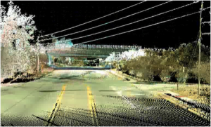
Example of Mobile Laser Scan Data
A mobile vehicle mounted system on the other hand can scan more than 50 miles of roadway per day. That is an enormous difference. But this system has the same limiting factors as the tripod system of being less effective in heavily congested areas. It is standard procedure on mobile scanning projects to run the travel lanes multiple times to get the best results. So the production rate per day of the Mobile is 10 times (or more) greater than the tripod mounted system.
So on the face of it the mobile system sounds better, faster, and most efficient. That is not always the case. On real projects where we have compared systems to systems the cost for less than 10 miles of roadway is the same or a little less for the tripod mounted systems and the time frames is about the same for the completed deliverable. Above 10 miles our experience has shown us that the mobile vehicle mounted system is probably more cost efficient. Why? The mobilization cost of getting a Mobile system on site. Much like an aerial lidar job, sometimes the biggest cost is getting the aircraft over the site. The same is true for mobile mapping. The cost to get a mobile unite on your job can be $5000, or more, for the first mile. The other factor is that it cost more to process the mobile data as you need to analyze and the various systems and make sure that the GPS and satellites are all working and collecting correctly. Generally some type of test run is recommended. I recently priced a job both ways and if you included all the variables 6 miles of road way came in at just under $30,000 and with mobile the cost was closer to $40,000 and I had some prices over $50,000.
There are still two other factors to consider. As a surveyor I don’t get many transportation projects that are over 8 or 10 miles. It is just that most projects, because of construction cost and size and cost generally stop at less than 10 miles. There are exceptions, like long paving jobs that go 40 or 80 miles but they may or may not require highly detail surveys.

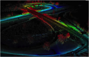
Bridge Interchange Project by LandAir Surveying
The other factor is speed. If speed is important because of urgency to a project or danger there are many application where the data should be collected with a mobile unit. Two examples; First a 10,000’ runway project on a busy airport. Normally the client will not allow you to close that type of runway for long periods of time for any reason. So for situations like this typically a mobile system is preferred. Another example is a very complicated area where there is a necessity for a very fast turnaround of the data. Some fast track projects require asbuilts data before the next phase of a project can be started. In these cases mobile scanning has some advantages and the difference in cost maybe worth the savings in time.
Conclusion: Both systems can get good survey grade data if they are used by experienced technicians that understand what they need to be successful. On actual projects I have priced, projects less than 8 or 10 miles are more cost effective with Tripod mounted systems and projects longer than this are faster and usually less expensive with the Vehicle mounted systems. One last note! It is important to remember that collecting the hard pavement surfaces is only about 20% to 25% of a normal transportation job.
H. Tate Jones PLS
7.11.2011

Leave a Reply
Want to join the discussion?Feel free to contribute!