Posts

3D Laser Survey: The new industry benchmark

Having just turned 60 years-old, I hit one of the major benchmarks in life.

When I was younger, I can remember thinking 30 was as old as you could ever get. Time changes the way we think about things.

I started my business in 1988 and still enjoy running our firm 25 years later. I have lived through the changes from ink on Mylar to Cad drawings, the introduction of GPS and the effect the internet has had on all of our lives. The latest change in the engineering world is the natural progression from 2D plans to 3D deliverables.

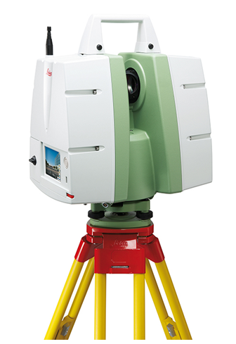
In 2005, when we started collecting data with high definition lasers, we were on the cutting edge. Today, this method is becoming even more mainstream.

Most of the sales we made in those first years required us to collect data in 3D and turn it into a 2D AutoCAD or Micro station deliverable. Today, probably 15-20% of our clients just ask for the “point cloud” data and use software that is written for their design and construction needs, making the information much more user friendly. How the industry has changed.

Transportation
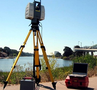
For many decades, we went out and surveyed roads the same way using digital survey equipment. While we still use traditional GPS and total stations, we incorporate 3D laser scanning more and more.

We were on teams that won some of the intersection projects north of Atlanta on I-85. On all of these projects, we scanned the roads, ramps, bridges and main line. Why? Because safety is always #1. Our surveyors don’t go into traffic or stand by the road unless there is no other way to do the job.

We were also able to produce very precise useable bridge data in a relatively short timeframe, which allowed our clients to begin preliminary planning. Another benefit is that the free point cloud viewer that comes with every project allows the client to visit the site, make precise measurements, and view the project in 360-degree photography without leaving their desks.

Nothing is more valuable than a site walk, but trying to remember if there were four light poles or six at a crucial intersection can be solved instantly with the click of mouse. Micro Station, AutoCAD and Revit now have programs that can import 3D survey data directly into the design file, which is a very big advantage for designers.

Structural Elements
In 1978, I was asked to survey the interior of Lenox Mall in Atlanta and produce an as-built for a structural survey. We used a steel chain and offset lines and it took many days to document simple column lines.

Now we can capture and document the most extreme and difficult data in just a few hours. We regularly use laser scanners to document wall failures, roof collapses, and to certify that massive complex structures are build per the design drawings.

Imagine having to perform a complex as-built survey of something like the Georgian Dome without a laser scan. It would be unthinkable! Likewise, engineering for tank farms and pipe transfer areas are much easier to document with a scanner.

Today, more and more clients are asking for a “laser survey” and then importing the registered point cloud data to begin designing the “fix.” As a result, travel expenses are roughly one third of what they were before.

Architecture
New Greenfield architectural as-builts are required and one day in the not too distant future they will require a laser scan point cloud to document the final conditions.

The real advantage in the 3D world is when you can scan older buildings that are not uniform and not consistent prior to construction and find all of the asymmetrical areas that will give a contractor and owner fits when construction begins.

For many reasons, we are documenting existing conditions in older buildings and in some cases they have very nice architectural features built by real artisans that we are able to capture to give the client a much clearer picture of what is there.

Older buildings have sagging floors, walls with varying thicknesses, and sometimes no interior air-conditioning or duct works. These are all areas where 3D technology is the only way to fly.

MEP Energy and Complex Plumbing
We call these highly complex environments. The original laser scanner was invented to map oil platforms and massively large refineries so that engineers could document and design the required elements correctly.

Unfortunately, there was no other way to do this. Weekly, I talk to clients who make 4-6 trips to jobs to check and recheck hand measured structures. Good news: there is no reason to do this ever again! Using a laser scanner is cheaper, faster and more accurate and once you capture the data, you have it forever. There is no better tool.

In this field, “smart point clouds” have turned from a dream to a reality. There are now programs that can automatically turn a point cloud into a series of pipes. Though it is not perfect yet, it is so much better than what was available in the past. The time it takes to model a pipe room is one third the time it took five years ago.

Most serious pipe designers are requesting laser scans on large projects. The new software models and performs clash detection and can export the data into many mainstream Cad platforms. This is now considered an industry best practice.

Low-tech Solutions
When we began in 2005, high speed laser scanners were our main tool. But unless the renovation was complex, the cost benefit for documenting relatively simple environments like hotels and commercial space was not very high.

For the past year, we have been providing Revit models of existing buildings cheaper and more efficiently than ever before. Previously designers sent interns or fresh college grads in the AEC industry to measure the space, who then took the data back to build a model.

Now we can measure the interior with a handheld laser and when we leave the building, the model is complete. Many projects can be completed in a single day. With a few hours of clean up the next day, the project is finished and out the door.

Our price is generally very competitive compared to the cost of sending designers to measure the space and the advantage is that they are designing and generating revenue. It is a win-win.

I am often asked by designers why they have to change the way they have been designing when it has been successful for decades. The answer is simple: there is a better way to do it.

With the advent of 3D printers, many designs will be printed and go straight from design to printer to the construction site with no human intervention.

The construction industry is changing, as are the designers who shape that industry. We have reached the new benchmark of 3D survey, design, fabrication and testing and there is just no going back.

###

Tate Jones has over 40 years of experience in land and aerial surveying and was one of the country’s earliest adopters of 3D laser scanning technology. A nationally recognized expert in the field of 3D data capture, he has worked with hundreds of clients in the engineering, architectural and construction industries. Contact him at tjones@lasurveying.com or visit www.landairsurveying.com.

3D Laser Scanning for Renovation of Healthcare Facilities

As a facility, hospitals and other healthcare buildings present a unique situation.

They have the aesthetic needs of a hotel or retail store, but the engineering requirements of an industrial or mechanical facility. These competing needs make space allocation difficult for design, construction, and operations and when renovations are due, accurate as-built information is absolutely critical.

3D laser scanning delivers perfect as-built information to meet the MEP and architectural needs of even the most complicated facilities.

Changes are always afoot in hospitals

Hospitals facilities are anything but static. Improvements in technology constantly call for new equipment and can shrink or modify the size of existing equipment. 

Equipment and mechanical rooms in hospitals are notoriously crowded. Walls, ceilings, kiosks, laboratories, and operating rooms are virtually full of pipes, wires, conduits, and other tools of the MEP (mechanical, electrical, and plumbing) world. 

This makes renovations difficult for both design and construction. 

There is a human factor, too. Office layouts change as employees are churned (or “moved” in facilities management terms). Departments often have to compete for space and square footage comes at a premium!

The health and safety of employees is also a consideration. Hospitals must comply with statutory requirements related to office layouts including the minimum amount of space per employee, security features, fire safety protocol, ventilation, temperature control, restrooms, dining facilities and more.

3D Laser Scanning: Perfect asbuilt information

3D laser scanning allows architects and engineers to design renovations from perfect as-built information. This directly addresses the need for accuracy within the tight tolerances of the hospital environment. Since human measurement error is eliminated, re-designs are greatly reduced and errors and omissions on the construction and architectural plans are also of no consequence.

3D laser scanning also gives contractors the upper hand. Since designs are based on actual existing conditions, the contractor can be more confident that it is constructible as designed.  Plus, precise material schedules developed from the model help avoid cost overruns.

The contractor can also use “clash detection” to determine exactly what must be moved or removed to complete the renovation. This technique compares the scanned as-built world to the construction plans and shows which areas are trying to occupy the same space. This significantly reduces change orders.

Owners and facilities managers also save money through efficient design and construction, as they can use the 3D picture of existing site conditions as a decision-making and communication tool during construction and a facilities management tool afterwards.

How it works

A 3D laser scanner uses harmless light rays to collect the 3D location of every object and surface it can “see” from where the instrument is set up. Scanners automatically rotate 360 degrees on a tripod, sending and receiving these light rays in all directions. In about five minutes, the scanner setup is complete and millions of data points have been collected. 

This data, which is known as a “point cloud,” is a perfect 3D asbuilt of existing conditions. The point cloud can be used by itself or modeled in a software program.

Advantages over traditional as-built techniques

3D laser scanning has many advantages over traditional measuring techniques including:

  • Accessibility: 3D laser scanners collect information from areas that can be seen but not easily accessed. For instance, scanners can collect information about MEP pipes and wires running along ceilings and other inaccessible areas.
  • Speed: Each scanner setup takes less than five minutes, so scanning crews can be in and out of an area quickly, without disturbing patients and without compromising the integrity of the data.
  • Safety: Since the scanners use harmless light rays to take measurements, neither patients nor field crews are affected. In fact, field crews do not have to be in a place to measure it.
  • Detail: No other data collection system records such precise information. Architects can see finishes, molding, and other aesthetic features and engineers can measure the locations of all objects seen by the scanner.

Conclusion

The strengths and efficiencies of 3D laser scanning are extraordinarily applicable to the unique environment of healthcare facilities. From design through construction and facilities management, all parties benefit from the precise as-built information given by this remarkable technology.

###

David Headrick has over 20 years of experience in the surveying, engineering, and legal industries, both as a project manager for LandAir Surveying and as a lawyer in private practice.  He has represented numerous land surveyors, designers, architects, contractors, and other industry professionals throughout his career.  Today, David serves as an executive and project manager for LandAir Surveying Company, Inc., focused on developing and managing the company’s 3D Laser Scanning Division.  Contact him at (865) 599-0148 or dheadrick@lasurveying.com.To view his LinkedIn profile, click here.

Five reasons to consider laser scanning in 2013…

Blog 5 photo c10 scannerI hope you are off to a wonderful New Year! In the theme of the New Year, I continue to be amazed at all of the new applications for laser scanning that our clients are coming up with or projects they inquire about measuring.

Hopefully this blog will inspire you to think of opportunities to utilize our services in 2013 to make your next project even better.

As-built data capture has always been a challenge for the AEC community and owners of assets. The outdated methods of gathering data are time consuming and lack accuracy and utilizing these record drawings can be inexact.

LandAir Surveying uses the latest technologies to help our clients. Whether you are looking for accurate as-built floor plans, historic preservation of a structure or MEP surveys in the plenum of a ceiling, we have an accurate and cost-effective solution for you.

Over eight years ago, we began utilizing the revolutionary technology of laser scanning. Our first laser scans were for the transportation industry, performing bridge surveys. Through these and other projects, we found laser scanning to be superior to traditional methods of data capture for a number of reasons:

#1: They are more precise.

A laser scan takes multiple scans to collect millions of data points. These scans are then registered together to generate a single three-dimensional “point cloud” that can be measured accurately and provides distances and elevations between points on X, Y & Z coordinates.

#2: They are versatile.

Laser scans can produce (when used with digital color photos) survey quality files, fly-through videos, BIM Models and CAD drawings.

#3: They are fast.

A single laser scan can be collected in around six to eight minutes. This enables crews to take many more scans and capture more detailed data than ever before. It also allows for accurate surveys to be done with minimal interruption to building occupants.

#4: They are safe.

Laser scanning provides a safer environment and allows crews to measure in places that would have previously been impossible.

#5: They save you money!

Finally, laser scanning almost always pays for itself. Here are a few examples of ways laser scans can save you money on your next project. Here are a few examples of ways laser scans can save you money on your next project:

  • You can always revisit the original scan multiple times from your computer desktop without the time and expense of traveling to the site again and again. With a laser scan, you can even revisit the site from your desktop years after the initial scan.
  • The quality of data collected can minimize or eliminate the need for construction reworks and field retrofitting.
  • The number of change orders due to erroneous design and unknowns in the field are dramatically reduced.
  • Material waste is reduced and the amount of production in the shop is increased.
  • Coordination between design and construction teams is greatly improved by providing visual documentation for discussion.
  • The speed of design is increased by providing accurate as-built conditions and clash detection.
  • Bid documents can be created from as-built data, resulting in lower-priced bids and a quicker schedule.

As you can see, the reasons for laser scanning are compelling. But what types of projects are best suited for this technology? In our experience, we have seen the greatest return on investment for laser scanning on projects that are complex and difficult to measure. Those projects with precise measurement requirements and a required speed of data gathering typically yield the greatest return on investment.

We have scanned miles of tunnels, airport conveyor systems, MEP structures that look like pipe “spaghetti,” hotel and casino atriums, and theaters and stadium grandstands with thousands of different sized structural beams. Laser scanning was by far the best solution for these projects.

While complex projects are great opportunities to utilize laser scanning technology, other advances in virtual design and construction solutions have allowed us to provide results for less complex environments.

New software and measuring solutions allow us to provide detailed as-built drawings and 3D models for hotel rooms, retail spaces, classrooms and offices with amazing speed and at a greatly reduced cost-per-square-foot over traditional architectural surveys. Field measurements to productions of floor plans and even Revit models can now be delivered in days.

From the industrial, manufacturing and energy sectors to hotels, hospitals and retail spaces – LandAir can provide solutions to make your next project more efficient and affordable.

###

Mitch Dorsett has over 15 years in the building and construction industry and serves as director of business development for LandAir Surveying. Mitch is rapidly becoming an expert in 3D data capture and virtual design and construction, having attended and represented LandAir’s laser scanning capabilities at SPAR, RTC and Autodesk University in 2012. Contact him at mdorsett@lasurveying.com or visit www.landairsurveying.com.

Where we are now…and where we’re going.

As 2012 winds down and we get ready to head to Las Vegas for the Autodesk University conference, I look back at the strides that have been made in the 3D world and all of the associated hardware and software in our industry.

Not only is there new technology being used and accepted, but the demand for more BIM products, users, and technologists has grown faster than ever. I have also watched with great interest the wave of corporate acceptance that was not there even three years ago.

There is still much ground to be broken, but wow – what a year!

New Software

Take software, for example. As I travel around America and talk to user groups and clients, the one thing I am always asked is when will it be easier to model point clouds into usable entities?

There is much research going on to solve this challenge. Though I have no commercial interest in this firm, I believe one of the ones to watch in this space is ClearEdge 3D. Their EdgeWise Plant software is pushing the barriers away for modeling point clouds.

Personally, I believe that within the next three years, this major barrier we face now will be a minor issue and point cloud use will continue to grow and expand.

The other great leap in technology is that most of the major software packages have updated their products to accept point clouds as a layer. This means that most of our clients in the architectural and MEP worlds can now import our point clouds into their design software and greatly enhance their designs.

Just three or four years ago, using point cloud data required modeling and this limited the market to mechanical and structural engineers and various contractors with specialty software.

Today, because all Revit users can import point cloud data, the need to model everything in a scan project has been greatly decreased. This is a big deal! Now, instead of having to pay for an expensive model, end users get all of the benefits of point cloud precision without the associated costs of modeling.

Not to be overlooked, there are still issues that will need to be ironed out in inserting point clouds into design software, but they will be overcome with time.

For example, if you are working in Inventor to model plant process data, it is best if the project is modeled from start to finish in Inventor. Similarly, if it is to be modeled in Revit, it is best that it be modeled from start to finish in Revit. There are no readily available universal translators to move from a model that was created in Cyclone to a model in Revit while keeping the full integrity of the original model.

Though the data itself is globally transferrable, the structure of the models, entities, families and libraries requires more work to be done in this area.

New Hardware

Last year, I predicted that the hardware in our industry was set and that most of the changes would come in the form of software. On this point, I was wrong.

Several changes have occurred that continue to advance the hardware. For example, The Faro Focus 3D has broken the price barrier. Prior to its release, most scanners started around $80,000 and went up to $200,000. The Focus was released at about $50,000 and has caused price adjustments throughout the industry.

I believe this trend will continue and prices will continue to go down. This is both a good and bad thing for the industry. As prices go down, more people with marginal training and experience will begin to use scanners and bad point clouds will become more of a problem.

There is a saying in our industry that “one bad point cloud kills a lot of clients.” Indeed, this is true. I have talked to clients who tried laser scanning nine years ago, had a bad experience, and will not use it again to this day. The problem is not that scanners are getting more affordable, but that there are still no national standards in the industry.

The upside is that with a lower cost competitor, vendors must consider what value their laser scanners bring that others do not.

Cool New Technology

Two things I am really interested in and know will change the playing field moving forward are   aerial drones and augmented reality.

These two technologies are growing fast and have many great uses. A traditional helicopter used to map utilities and large areas generally costs about $25,000 per day. A one-meter drone quadripod, on the other hand, costs about $2,000 per day.

Though there are unique tasks that the smaller one-meter drones can do that the helicopter is currently doing, there are other tasks that the smaller drones can perform that traditional helicopters cannot do. For example, smaller drones can more effectively and safely map underground pipes, mines and tunnels.

Currently, to send two scanner technicians into a tunnel requires about six surface and sub-surface support staff. An unmanned drone with avoidance technology would be a great solution.

Augmented reality and the ability to project 3D images easily and to large groups is available and is changing the whole world of education. A small but growing company, ViziTech USA, is doing very creative and trendsetting work in this area.

This is where the science of 3D technology is repackaged so that the average person can use and understand it. This is a powerful tool and will lead to great changes in many industries and educational processes. For more on augmented reality, read our recent blog post here.

The design and construction of future projects will still require the same basic processes that are required today. But the use of precision data before, during and after construction – and the visual way the data can be viewed – will greatly reduce errors and downtime events.

###

Tate Jones has over 40 years of experience in land and aerial surveying and was one of the country’s earliest adopters of 3D laser scanning technology. A nationally recognized expert in the field of 3D data capture, he has worked with hundreds of clients in the engineering, architectural and construction industries. Contact him at tjones@lasurveying.com or visit www.landairsurveying.com.


Scan to BIM: The evolution of scanning technology

The truth is, scanning is the only cost-effective way to collect the existing world.

You simply can’t go into a cathedral, petroleum refinery, or metropolitan multi-use entertainment facility and measure with rulers and expect to get the accuracy you need to confidently design renovations.

Laser scanning is the only way to do it.

Up until recently, BIM users would take a set of “asbuilt drawings” put them into a 3D modeling program and create a computer model to work from. Now, after several years of doing that, the harsh realization has surfaced that there are many discrepancies between the “record drawings” and the actual environment to be constructed.

If it’s sheet rock and wood, it can be adjusted to fit. But if it’s glass, steel, concrete or mechanical equipment, a seemingly small error can grow very costly as it is much harder to warp and bend. (Putting expensive new equipment into an area that is too small is a nightmare for the installer, designer, engineer and the insurance company.)

These new 3D laser scanning technologies have dramatically changed the surveying industry – and they have changed it fast. But to really understand the evolution, let’s take a step back….

2004: 360-Degree Scans

The first 360-degree scanners came onto the scene around 2004. Before that, if you wanted to scan something above your head, you had to tilt the scanner back and scan at a steep angle, as most only had a 120-degree scan ability on the vertical axis. Several companies came out with full straight scanners about this time that made it much easier.

2006: Time-of-Flight Scans

The next evolution was time-of flight scanners. In 2006, a time-of-flight scanner took about 45 minutes to one hour for a complete 360-degree scan. If you could do 8-10 scans a day, you were doing very well. Today, the same can be done in about 12-15 minutes, depending on the density you want a scan.

At our firm, our first scanning projects were roads. In a very complicated area, we would scan 1”X 1”. The time-of-fight scanners back then could collect 4,000 points per second. Now they can easily collect 50,000 points per second!

2008: Phased-Based Scans

Today’s phase-based scanners collect 2,000,000 points per second and can create a ¼-inch x ¼-inch pattern at a distance of about 100 feet. This is incredible and as fast and dense as the average user needs. The hardware will eventually get better, faster and cheaper, but phase-based scanning is effective, stable, and provides the ability to scan almost anything in a reasonable about of time.

Present: Scan to BIM

Today, the big research money is going towards Scan to BIM technology, which converts billions of points in the point cloud into useful data.

Several companies have begun addressing this including small independent companies like Pointools, which came up with a way for scanners to recognize flat surfaces. (As small as this may seem, it is a huge advancement.) The program will also recognize pipes and model them automatically about 50% of the time. (Another major advancement.)

Now many of the pipe programs are getting to the same place and advancing the ball. Currently, we are at what I call the “Model T Ford” in software programs, but every year the programs get better.

The next evolution

Having now scanned may very complex areas in industrial sites, we have had a chance to compare them to the asbuilt drawings. In the horizontal view, they are generally close geometrically to the actual. But in their vertical axis, the pipes and duct work in the asbuilt drawings are rarely correct.

There are many reasons for this, but most often it is because the process is so difficult that when an installer sees an easier path, he generally takes it.

“Record drawings,” or asbuilt surveys, are rarely done after the work is complete. Typically, the conversation goes something like this: “Here are the design drawings. Redline any changes that you made.”

There is not a lot of motivation to do a totally new survey. But if a design team takes these documents and models them into their computer programs, they are unknowingly creating multiple problems for the contractor on the new job.

We recently took a set of asbuilt documents for a complex project, modeled them and then compared them to the point cloud to do a clash detection to determine potential interferences. The outcome was eye opening.

Few of the pipes, ducts, waterlines or fire lines in the ceiling were in the place shown on the record drawings. If these documents had been used, the MEP contractors would have spent ten times our fee “field fitting” the new utilities inside the old.

With the utility and cost of laser scanning, it would be smart to use one on every renovation project. If for nothing else, insurance! Just one field fit can sometimes cost far more than the scan itself.

If you scan the environment and put the proposed design into the point cloud, you can tell in just a few minutes where the major interferences will be. We have found conflicts that would have taken upwards of $100,000 to fix if they had to be field-changed during construction. Some were fatal flaws in the required design clearance that could not have been achieved and a totally new design would have had to been submitted.

Scanning to BIM is a big and extremely important step in surveying. Right now, it is the design software that is trying to catch up with the scanning potential. Already this year, several new programs have come out that are much better at accepting point clouds and computer models, but they still have a long way to go.

Not having a design based on a laser scan of the actual environment is a risk that few designers should take. I know I wouldn’t want to tell an owner that there is a construction problem that could have been avoided with a relatively inexpensive laser scan.

Laser scanning has evolved from a “luxury” to a best practice and it’s not a step that any prudent designer should skip.

###

Tate Jones has over 40 years of experience in land and aerial surveying and was one of the country’s earliest adopters of 3D laser scanning technology. A nationally recognized expert in the field of 3D data capture, he has worked with hundreds of clients in the engineering, architectural and construction industries. Contact him at tjones@lasurveying.com or visit www.landairsurveying.com.