Posts

LandAir Surveying at the American Society of Civil Engineers (ASCE) annual meeting…

LandAir Surveying will be presenting on 3D laser scanning to the American Society of Civil Engineers (ASCE) annual meeting for its Tennessee section this Friday, August 23. The all-day program will be held at Buddy’s in Bearden, Tennessee, and will feature multiple speakers. Our own David Headrick will be presenting at 1:00 PM (EST)!

3D laser scanning: the perfect choice for fast-growing automotive industry

The automotive industry is firing on all cylinders – especially here in Tennessee. For the fourth year in a row, the state has been ranked No. 1 in auto industry strength.


Not only has Nissan been operating here for 30 years, but Tennessee is also now home to General Motors and Volkswagen’s operational plants, as well as Magneti Marelli and a number of original equipment manufacturers. In the last year, Tennessee hosted 44 automotive projects generating over $1 billion and thousands of jobs.


Earlier this month, GM announced plans to add 1,800 jobs at its Spring Hill assembly plant over the next three years so that it can begin building two new midsize vehicles.


In June, Nissan Motor Co. announced that it will add 900 jobs at its plant in Smyrna, just northeast of the GM plant. Also this month, Nissan announced plans to up production of its electric motors in its engine factory in Decherd, Tennessee. The plant is already staffing up to launch a third work shift to accommodate production.


As the automotive industry continues to grow, 3D laser scanning can play a major role in the redesign and construction of these plants.


This high definition scanning technology is the perfect tool to help automotive manufacturers retool their assembly lines, update their as-built drawings, and maximize efficiency of their production line layout.


How, exactly, can 3D laser scanning help?


#1: Reduced risk. Not only is laser scanning safer than traditional scanning methods because it allows crews to measure in places that would have previously been impossible, 3D laser scans also save money by eliminating the need for construction reworks and field retrofitting. Because of the quality of the scanned data, the number of change orders due to design flaws and unknowns is dramatically reduced.


#2: More precise. A laser scan takes multiple scans to collect millions of data points that are then registered together to generate a single three-dimensional “point cloud” that provides accurate distances and elevations between points on X, Y & Z coordinates. This accuracy provides the ability to perform better simulations and visualizations for training and monitoring purposes.


#3: Regulatory compliance. As governmental regulation and scrutiny increases, factory owners must ensure the as-built and as-maintained condition of production assets is in compliance. Laser scanning can be used to ensure plants are always safely within the regulatory guidelines.


#4: Huge cost savings. Laser scanning enables designers and engineers to revisit the original scan multiple times without having to physically return to the jobsite. Coordination between design and construction teams is greatly improved by providing visual documentation for discussion, and expensive construction reworks are greatly reduced.


Additionally, schedule compression of as much as 10% has been reported when 3D laser scanning has been deployed. This means big savings – especially on projects where outage time can cost as much as $1 million per day!


Conclusion

As the automotive industry continues to expand, 3D laser scanning technology can be an invaluable asset to the construction and redesign efforts of auto manufacturers to increase accuracy and efficiency while significantly saving both time and money.


###


David Headrick has over 20 years of experience in the surveying, engineering and legal industries, both as a project manager for LandAir Surveying and as a lawyer in private practice.  He has represented numerous land surveyors, designers, architects, contractors and other industry professionals throughout his career.  Today, David serves as an executive and project manager for LandAir Surveying Company, Inc., focused on developing and managing the company’s 3D Laser Scanning Division.  Contact him at (865) 599-0148 or dheadrick@lasurveying.com.

Five reasons to consider laser scanning in 2013…

Blog 5 photo c10 scannerI hope you are off to a wonderful New Year! In the theme of the New Year, I continue to be amazed at all of the new applications for laser scanning that our clients are coming up with or projects they inquire about measuring.

Hopefully this blog will inspire you to think of opportunities to utilize our services in 2013 to make your next project even better.

As-built data capture has always been a challenge for the AEC community and owners of assets. The outdated methods of gathering data are time consuming and lack accuracy and utilizing these record drawings can be inexact.

LandAir Surveying uses the latest technologies to help our clients. Whether you are looking for accurate as-built floor plans, historic preservation of a structure or MEP surveys in the plenum of a ceiling, we have an accurate and cost-effective solution for you.

Over eight years ago, we began utilizing the revolutionary technology of laser scanning. Our first laser scans were for the transportation industry, performing bridge surveys. Through these and other projects, we found laser scanning to be superior to traditional methods of data capture for a number of reasons:

#1: They are more precise.

A laser scan takes multiple scans to collect millions of data points. These scans are then registered together to generate a single three-dimensional “point cloud” that can be measured accurately and provides distances and elevations between points on X, Y & Z coordinates.

#2: They are versatile.

Laser scans can produce (when used with digital color photos) survey quality files, fly-through videos, BIM Models and CAD drawings.

#3: They are fast.

A single laser scan can be collected in around six to eight minutes. This enables crews to take many more scans and capture more detailed data than ever before. It also allows for accurate surveys to be done with minimal interruption to building occupants.

#4: They are safe.

Laser scanning provides a safer environment and allows crews to measure in places that would have previously been impossible.

#5: They save you money!

Finally, laser scanning almost always pays for itself. Here are a few examples of ways laser scans can save you money on your next project. Here are a few examples of ways laser scans can save you money on your next project:

  • You can always revisit the original scan multiple times from your computer desktop without the time and expense of traveling to the site again and again. With a laser scan, you can even revisit the site from your desktop years after the initial scan.
  • The quality of data collected can minimize or eliminate the need for construction reworks and field retrofitting.
  • The number of change orders due to erroneous design and unknowns in the field are dramatically reduced.
  • Material waste is reduced and the amount of production in the shop is increased.
  • Coordination between design and construction teams is greatly improved by providing visual documentation for discussion.
  • The speed of design is increased by providing accurate as-built conditions and clash detection.
  • Bid documents can be created from as-built data, resulting in lower-priced bids and a quicker schedule.

As you can see, the reasons for laser scanning are compelling. But what types of projects are best suited for this technology? In our experience, we have seen the greatest return on investment for laser scanning on projects that are complex and difficult to measure. Those projects with precise measurement requirements and a required speed of data gathering typically yield the greatest return on investment.

We have scanned miles of tunnels, airport conveyor systems, MEP structures that look like pipe “spaghetti,” hotel and casino atriums, and theaters and stadium grandstands with thousands of different sized structural beams. Laser scanning was by far the best solution for these projects.

While complex projects are great opportunities to utilize laser scanning technology, other advances in virtual design and construction solutions have allowed us to provide results for less complex environments.

New software and measuring solutions allow us to provide detailed as-built drawings and 3D models for hotel rooms, retail spaces, classrooms and offices with amazing speed and at a greatly reduced cost-per-square-foot over traditional architectural surveys. Field measurements to productions of floor plans and even Revit models can now be delivered in days.

From the industrial, manufacturing and energy sectors to hotels, hospitals and retail spaces – LandAir can provide solutions to make your next project more efficient and affordable.

###

Mitch Dorsett has over 15 years in the building and construction industry and serves as director of business development for LandAir Surveying. Mitch is rapidly becoming an expert in 3D data capture and virtual design and construction, having attended and represented LandAir’s laser scanning capabilities at SPAR, RTC and Autodesk University in 2012. Contact him at mdorsett@lasurveying.com or visit www.landairsurveying.com.

3D laser scanning revolutionizes construction site accident investigation and evidence collection

In early October 2012, several construction workers were killed or injured when the Miami Dade College parking garage collapsed like a pancake, trapping a then-unknown number of workers inside (See http://tinyurl.com/9956xae). Some survived, but some did not.

Post-accident site investigation

Since this tragic loss of life, injury, and property damage, lawyers have no doubt already begun what will be expensive and lengthy litigation. The owner, architect, engineer, contractor, subcontractors, construction workers and their families will all play a part.

The evidence may be sifted and sorted for years before any judges or juries hear about what happened on that fateful day.

Ideally, each party would have ample opportunity to investigate the site, take measurements, and form opinions as to what happened. However, this was not an option in Miami.

Workers needed to be freed. The structure’s potential for further collapse endangered all those around it. The owner had a dangerous pile of rubble where a new parking garage was supposed to stand. Certainly, nobody wanted to preserve site conditions for any length of time.

So, how can evidence of existing site conditions be preserved forever? 3D laser scanners were dispatched to the site immediately.

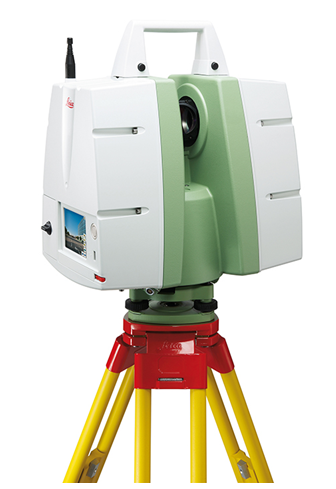
From onsite scan to a 3D model on your computer

Similar to traditional surveying, 3D laser scanners are set-up on tripods and use light to precisely measure their surroundings. But whereas traditional land surveying instruments take only one measurement at a time and need a reflector to return the light, 3D laser scanners take millions of measurements of everything that they can “see”  within 300 feet.

This data is collected in a matter of minutes and the instrument can be set up as many times as necessary to see the entire site. Technicians then convert this raw information into a 3D model.

Lawyers and their experts can use this model to return to the day of the accident at any time.  They can pan and zoom around the model to find any desired vantage point. Any angle or distance can be measured and re-measured.

Collecting quality evidence

After any given construction accident, investigators take photographs, make measurements and sketches, and interview witnesses.  However, even the most seasoned investigator can miss critical details due to time constraints, site access, or simple knowledge of the facts.

Once the site is cleaned up or altered in any way, the evidence is spoiled. However, 3D laser scanning allows investigators to return to the site at any time to retrieve missed or forgotten details.

Additionally, the evidentiary quality of 3D laser scanning data far outweighs traditionally collected evidence. Photographs provide only a single 2D perspective and each detail must be specifically targeted. Manual measurements are subject to observational and recording error.  Witnesses certainly cannot permanently remember every visible detail, especially in the wake of a tragedy. 3D laser scanning overcomes all of these limitations.

Full access to the site is often limited, for example, from the danger of additional collapse and loose rubble around the parking garage in Miami. This problem is also overcome with 3D laser scanning, as it uses light to measure from a distance. Anything that can be seen can be scanned and recorded for later review.

Using the model at trial

3D laser scans are not new to the courtroom and readily pass muster under evidentiary challenges. Foundation for entering a 3D laser scan on the record can be laid by a professional land surveyor, but courts nationally have allowed scans based on the testimony of laymen who were simply certified to use the equipment.

At trial, 3D laser scans provide unparalleled demonstrative exhibits. Judges and juries will no longer need to travel to visit a site.

As noted by Lt. Warren Hamlin of the Knox County Tennessee Police Department, “It’s almost like taking the jury right to the crime scene. We can show pictures all day long, but when you’ve got a panoramic view that shows exactly how it looked and where everything was, that’s a much better depiction than a photograph. … So, if a guy says, ‘I was standing in that corner,’ you could create a viewpoint exactly where his head would be and look around the model and tell whether, yes, he could see that, or, no, he’s lying.”

###

David Headrick has over 14 years of experience in the surveying, engineering and legal industries, both as a project manager for LandAir Surveying and as a lawyer in private practice. He has represented numerous land surveyors, designers, architects, contractors and other industry professionals throughout his career. Today, David serves as an executive and project manager for LandAir, focused on developing and managing the company’s 3D laser scanning department. Contact him at dheadrick@lasurveying.com.