SPAR 2011 Conference – Houston, Texas – Part 1
 I always look forward to the SPAR conference and this year was no exception. SPAR 2011 was held last week in Houston, Texas. For Surveyors, Engineers, Architects and lidar users and providers, this is the biggest show in America that features 3D Data capture of all kinds. As President of LandAir Surveying, it is probably the most important conference that I attend each year. I have been attending the conference since 2005. All of the various professionals in related industries attend and get to interact with all the Hardware and Software service providers who are there to show the “Great” improvements that have occurred over the past year. I will say this year was exceptional in two areas. First, automated point cloud modeling is coming along at a faster pace than even I expected. More on this later. The other notable improvement is how much photography is being used to supplement and even create 3D point clouds. Overall this years conference was very impressive and showed how the technology is being embraced by more and more professionals and industries.
Overall Impressions
 First, this was the largest crowd ever to attend, as there were over 800 attendees from all the continents across the globe. There were special pins given out to memorialize the recent events in Japan and the challenges that country faces. The opening speaker Brian Matthews, with Autodesk Research laboratories was way over the top and was working on things and inventions so far ahead of where we currently are it was breath taking. He showed great examples of how his group and others like them are pushing the envelope: from flying digital aerial photography with $100,000 drone unmanned helicopters, to showing us the improvements in 3D printing and how many companies are starting to use that technology, to create working models of machinery without outsourcing the prototype creation.
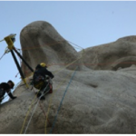
 Another notable Speaker was Ruth Parsons the Executive Director of Historic Scotland. Her group has an ambitious project to document the “Scottish Ten”. The ten is a reference of their endeavor to document in full 3D the top 5 World Heritage sites in Scotland and the top 5 equivalent international sites around the world. They are part of a group of non-profits that have taken on this task. The Scottish team in conjunction with Cyark (founded by Ben Kycera one of the inventors of the Laser Scanner) work together to document Mt Rushmore and did quite an impressive job. Expert climbers were used to strap 3D Laser scanners to the side of the mountain carved statues. Ironically 3 of the 4 men carved on the mountain were Land Surveyors. Several presentations have been made on the project which is really astonishing.
 Generally the conference was very successful in displaying and teaching the long strides this industry has made in the last decade. New to the conference technology was the addition of underwater scanning presentation. Few know or understand that it was underwater scanning that allowed the oil well in the Gulf of Mexico to be capped in the Summer of 2010. I would tell anyone who is interested in 3D Laser scanning to attend this conference as every year it gets better and more complex.
H. Tate Jones PLS

Leave a Reply
Want to join the discussion?Feel free to contribute!