
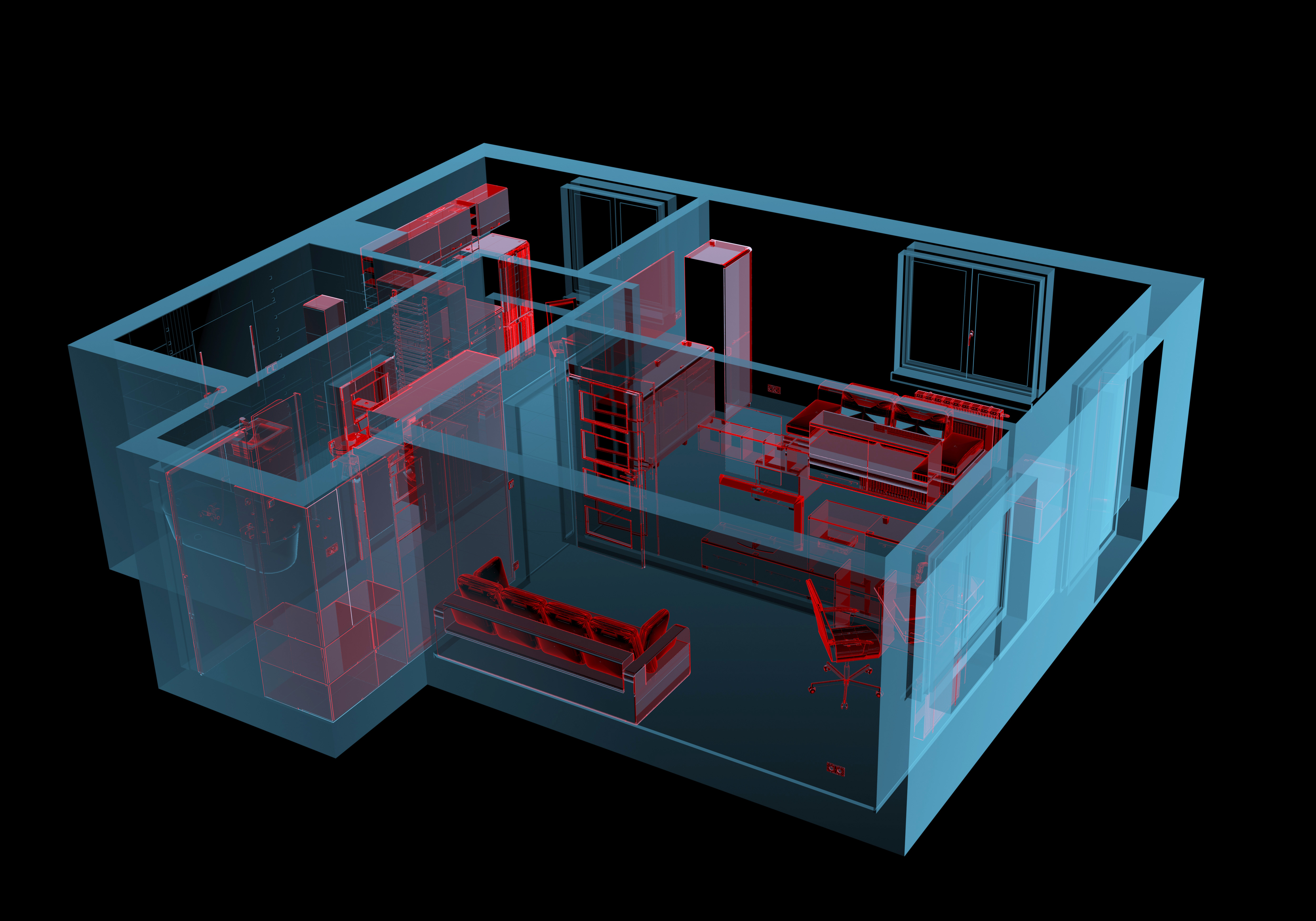
 Laser scanning is a relatively new technology, having been used as a precise survey instrument only since 1998. Now, it is quickly becoming the new industry standard as a way to make very accurate measurements in complicated environments. This is precisely why using this technology is the best solution for measuring as-built conditions inside buildings. This instrument collects survey data points at a rate of 50,000 points per second. It has an effective range of 400’ to 500’. With several “scan” setups inside a room or of a building, a complete 3D model can be made of the existing conditions. These models are then used to create 2D civil or architectural drawings, 3D computer models, and final survey documents.
3D Laser Scanning Services
Whether you call it 3D Laser Imaging, 3D Laser Scanning, 3D Laser Surveying or High-definition Surveying, this type of surveying which will become the norm in the future and can be delivered to you now by LandAir. Please view some of our example videos, below by clicking on the static images.
*Note that all videos are not the work of LandAir Surveying. Those noted with “by Others” are shown to present the wide range of other uses of this technology.
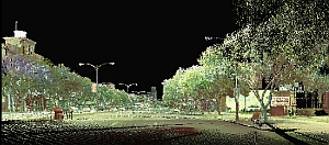 Laser Scan of Downtown Augusta, Georgia
LandAir Surveying used our Leica High Definition 3D Laser Scanner to perform a topographic and location survey of downtown Augusta, including 5th Street through 13th Street, for a length of 13,450’ and 17 acres, and along Broad Street. The project will be used as a base map for a major downtown revitalization project. New streetscapes, traffic signals, and utilities will be designed from our surveys. We also tied in the under- and above-ground utilities.
Webb Gin Road – Georgia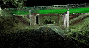
LandAir Surveying collected roadway profiles at 50’ intervals, including the crown and road striping. The survey limits were about 1,450’. We also surveyed two sidewalk expansions approximately 1,200’ south of the intersection of Webb Gin House Road and SR 124. We collected the visible surface utilities, and included the location and contours of an existing detention pond. The project was used to redesign the bridge underpass and roadway above.
High-Definition Laser Scanning For:
- Historical Preservation
- Detailed Measurements
- Surveying hard-to-reach areas
- Construction Progress
- Digital 3D Photos
- Video of Surveys
- MP3 and JPG Files
- Changes view to real-time 3D
- Reduce site visits
- Record exact data
Uses of the Technology:
- Volumetrics
- As-builts
- Mechanical Electrical Plumbing As-builts
- Change detection
- Structural as-builts
- Catastrophic event mapping
- Hazard surveying
- Accident reconstruction
- Registered photo video coordinates
Tools We Use:
-
Leica HDS P 40 Terrestrial Laser Scanner
- Scan rate: Up to 1’000’000 points per second
- Range accuracy: 1.2mm + 10 ppm over full range
- Angular accuracy: 8″ horizontal; 8″ vertical
- 3D position accuracy: 3 mm at 50 m; 6 mm at 100 m
- Target acquisition: 2 mm standard deviation at 50 m
- Dual-axis compensator: Liquid sensor with real-time on board compensation, selectable on/off, resolution 1″, dynamic range +/- 5′, accuracy 1.5″
- Laser plummet: laser class 1 (IEC 60825:2014)
-
Software tools:
- Autodesk
-Revit
-AutoCad
-3DS Max
-Navisworks
-ReCap - Bentley
-Descartes
-Microstation
-Pointools
-Navigator
-InRoads
-ContextCapture
-LumenRt - Global Mapper
- Pix4D
- Agisoft
- ClearEdge3D Edgewise
- Thinkbox-Sequoia
- 3DReshaper
- PTGui
- Pano2VR
- Leica Cyclone
- Autodesk