
LandAir has worked with many local municipal entities, including the cities of Alpharetta, Roswell, and Cartersville, and the counties of Cobb, Fulton, Dekalb, and Gwinnett.
Panola Mountain Bike Trail – DeKalb County, Georgia
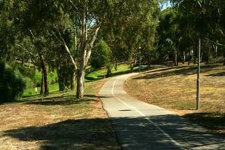 LandAir provided topographic information, right-of-way, and property line information along a 35,000’, 50’ wide proposed bike path corridor. The survey showed visible improvements, including pipe sizes and inverts for accessible storm and sewer pipe systems, and other visible utilities.
Law Enforcement Center – Alpharetta, Georgia
 This project, while seemingly simple at the outset, really had several elements that needed to be merged into the data. Initially, we started with an as-built of the north side of the law enforcement center. This included the secondary drainage system, trees, and spot elevations. Then, we added the property lines and the right-of-way of Kimball Bridge Road. However, Kimball Bridge Road, at that location, was going to be relocated, and the future Westside Parkway would be the exit to the law enforcement center. To get the City of Alpharetta what they needed, we located the existing Kimball Bridge Road, and performed a topographic survey in the field across Kimball Bridge Road. Next, we got the electronic plans for the parkway. We were able to orient the electronic plans to the control points we located and ultimately place the “Future Westside Parkway” on the topographic and as-built survey. The designer was able to design the new parking area between the face of the building and the future Westside Parkway. This project also required us to locate all visible utilities.