
Land Surveying has always and will always be the foundation of our company and the roots from which we grew. Our President begin Land surveying in 1968 as a summer job in Auburn, Alabama. In his life time Land surveying has moved from surveying with a 100’ chain and mechanical transit to using Global Satellite Positioning Systems that can fix a point on the earth surface with in a ¼ of an inch in less than 5 seconds. Think about that. Satellites are traveling at 8600 mph and from the geometry of the Satellite and the GPS signal to the ground the instruments can locate themselves with in ¼ of an inch.
It has been an interesting 40 years. Where is Land Air Surveying today and what Land surveying services do we offer. If you have seen our website, you will 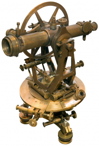 know that we are one of the leaders in America in 3D Laser Scanning and Lidar technology. However in that same way we are leaders in Land Surveying in the Southeastern United States. While 3D Laser scanning is a national market and we do travel all over the lower 48 states. Land Surveying by its very nature is more localized. To that end we are registered in 5 states. Georgia, Alabama, Tennessee, Florida, and South Carolina. We do most of our business in Georgia but we occasionally have projects in other states. So what services do we offer? The full complement of Land Surveying property large and small, Aerial Mapping, GIS, services, GPS services, Hydrographic Services and Forensic surveying on both Civil cases and Criminal Cases.
Most of our clients are in the Engineering, or Municipal, State, County government sector or in the Federal/Military sectors. Our largest market share has been transportation services for the Georgia Department of Transportation. It was through the needs of the Transportation Engineering industry that we begin to integrate all our services and use all the current survey tools on most projects to bring about the best result in the best time frame.
GPS Surveying Services
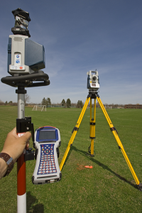 We started in this market, really it is more a technology than a market, in 1992 when few people understood the great advances and time saving using (at that time) duel frequency receivers. These receivers could locate survey grade points exactly within 10 minutes compared to several hours and sometimes days with the old technology. Now we use the technology to locate points precisely and check control stations. It we are not given an existing coordinate system we always use the GPS equipment to set State Coordinates. The greatest power of GPS is easily its ability to establish elevations almost immediately within about an inch which is all that is needed for about 99% of the jobs we do.
Transportation Land Surveying Services
We have surveyed hundreds of miles of State City and County roads and we are familiar with all the requirements 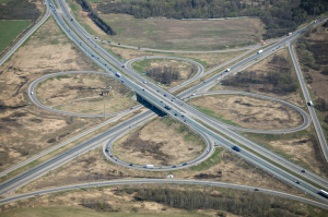 and nuances of providing this type of service to most of the top Engineering firms in the Southeast. Most importantly we understand the care it takes to merge all the data into one efficient database that contains the underground utilities, the property data, the planemetric data, the digital terrain data and the aerial data. We also understand the software needed and required to present the jobs, formerly Caice and now slowly moving to Inroads operating inside of the Micro Station platform. View our transportation land surveying services.
Traditional Land Surveying Services
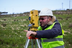 We still run boundaries and topographic surveys and produce many ALTA surveys as part of our services. This is still the base of our business and we take a lot of pride in doing them correctly and meeting the deadlines. We have worked with most of the larger real estate companies and legal real estate firms in the state. Our largest boundary was of 5000 acres and we have survey areas as small a 9 square feet.
Aerial Mapping Services
While we no longer own airplanes we still use aerial mapping as one of our main tools when we approach larger  projects. Having built one aerial mapping division in 1992 from zero income to over 1 million in revenues, and owned as many as two aerial firms at one time, we learned it was easier to team with very good firms and let them do what they do best, namely fly and collect the data. Then we merge the data with our data and give the clients a superior product. We also know from experience what the client needs to have his project come out well. Once we understand the needs of our client we can represent him with the aerial contractors and get him the result he wants. Typically we get better tighter results than they would get without our services and we can generally save them money by know who does best at what type of surveys.
So where are we headed?
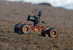 This Robot Drone is designed to go into places that are not friendly to humans and collect data and keep people out of harm’s way. The same types of sensors are being mounted in to remote control aircraft that can go places that normal planes cannot. You can survey from a moving vehicle that is traveling at 50 mph. The use of Orbiting Satellites is growing more and more common in collecting data over large areas. Where are we headed? We are in a new 3D digital data age and the analogue ways of the past for collecting data will not be used in the future.