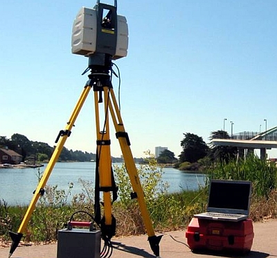
 LandAir Surveying Company is considered to be one of Atlanta’s top five surveying companies, and we are rated in the top three for advanced technology utilization and expertise. LandAir is a multi-discipline surveying firm that has provided professional surveying services to our clients for more than 18 years. Our company’s primary production facility is located in Roswell, Georgia, with a supporting production facility in Lawrenceville.
LandAir has completed over 50 databases working for the Georgia Department of Transportation, ranging from intersections to projects 20 miles in length. We use CAiCE to produce a 3D database, and MicroStation to accompany the database, to produce the standard CAD drawings with labels. All these projects have followed the Georgia Department of Transportation’s strict guidelines for levels, line weights, line styles, and symbols specified by the Electronic Data Guidelines.
We are currently licensed to perform land surveying services in the states of Alabama, Georgia, South Carolina, and Florida, and we have associations with other firms throughout the United States that enable us to meet your requirements nationally. In fact, we are willing to provide 3D scanning services throughout the world. In addition, we have a seasoned team of computer technicians who are proficient in AutoCAD, MicroStation, TerraModel, Leica Ski Pro, Cyclone, Cloudworx, and CAiCE software packages.
Another very important service we provide is our GPS/GIS services. We currently have ten dual frequency GPS receivers, allowing us to transfer elevations almost instantly and over great distances. As a normal course of business, we put every job on State Plane coordinates and elevations. With our Real Time Kinematic GPS technology, our crews can double the production of a standard survey crew. That means that our crews can produce work more cost effectively and efficiently, and bring in the project on schedule and within the budget.
Because we bring land surveying, GPS/GIS, and aerial mapping services together into one turnkey operation, we are confident that we can provide you the services you need.
